
Noble County topographic map
Interactive map
Click on the map to display elevation.
About this map
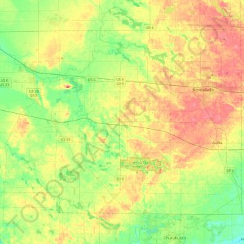
Name: Noble County topographic map, elevation, terrain.
Location: Noble County, Indiana, United States (41.26377 -85.65475 41.52662 -85.19209)
Average elevation: 284 m
Minimum elevation: 251 m
Maximum elevation: 327 m
Other topographic maps
Click on a map to view its topography, its elevation and its terrain.
Rome City
United States > Indiana > Noble County
Rome City, Noble County, Indiana, 46784, United States
Average elevation: 283 m