
McKee topographic map
Interactive map
Click on the map to display elevation.
About this map
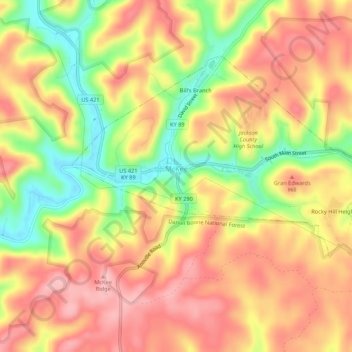
Name: McKee topographic map, elevation, terrain.
Location: McKee, Jackson County, Kentucky, United States (37.41478 -84.01397 37.44407 -83.96026)
Average elevation: 386 m
Minimum elevation: 301 m
Maximum elevation: 444 m
Other topographic maps
Click on a map to view its topography, its elevation and its terrain.
Wind Cave
United States > Kentucky > Jackson County
Wind Cave, Jackson County, Kentucky, United States
Average elevation: 341 m
Jack's Branch
United States > Kentucky > Jackson County
Jack's Branch, Jackson County, Kentucky, 40434, United States
Average elevation: 372 m