
Pszów topographic map
Interactive map
Click on the map to display elevation.
About this map
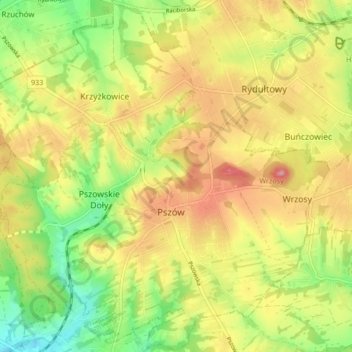
Name: Pszów topographic map, elevation, terrain.
Location: Pszów, Wodzisław County, Silesian Voivodeship, 44-370, Poland (50.01840 18.34908 50.07164 18.43296)
Average elevation: 273 m
Minimum elevation: 205 m
Maximum elevation: 340 m