
Querfurt topographic map
Interactive map
Click on the map to display elevation.
About this map
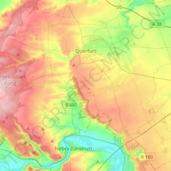
Name: Querfurt topographic map, elevation, terrain.
Location: Querfurt, Saalekreis, Saxony-Anhalt, Germany (51.27464 11.39304 51.41731 11.64855)
Average elevation: 201 m
Minimum elevation: 109 m
Maximum elevation: 298 m