
Artificial Island topographic map
Interactive map
Click on the map to display elevation.
About this map
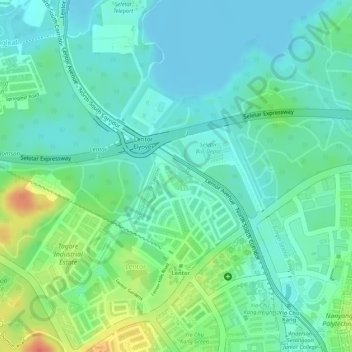
Name: Artificial Island topographic map, elevation, terrain.
Location: Artificial Island, Singapore, Central, Singapore (1.39160 103.83621 1.39179 103.83637)
Average elevation: 17 m
Minimum elevation: -1 m
Maximum elevation: 54 m
Other topographic maps
Click on a map to view its topography, its elevation and its terrain.
MacRitchie Reservoir
MacRitchie Reservoir, Chemperai Trail, Sin Ming, Singapore, Central, 298186, Singapore
Average elevation: 28 m
Fort Canning Park
Fort Canning Park, Clarke Quay, City Hall, Singapore, Central, Singapore
Average elevation: 19 m
Bulatan MacRitchie
Bulatan MacRitchie, Singapore, Central, 574623, Singapore
Average elevation: 22 m