
Galeras topographic map
Interactive map
Click on the map to display elevation.
About this map
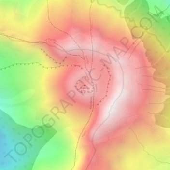
Name: Galeras topographic map, elevation, terrain.
Location: Galeras, Consacá, Occidente, Nariño, RAP Pacífico, Colombia (1.22148 -77.35901 1.22158 -77.35891)
Average elevation: 3,847 m
Minimum elevation: 3,243 m
Maximum elevation: 4,208 m