
Khavaran topographic map
Interactive map
Click on the map to display elevation.
About this map
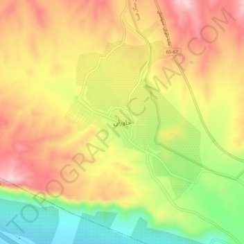
Name: Khavaran topographic map, elevation, terrain.
Location: Khavaran, بخش خفر, Jahrom County, Fars Province, Iran (28.91783 53.29477 28.95783 53.33477)
Average elevation: 1,380 m
Minimum elevation: 1,220 m
Maximum elevation: 1,515 m