
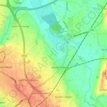
Mickle Trafford and District topographic map
Interactive map
Click on the map to display elevation.
About this map
Name: Mickle Trafford and District topographic map, elevation, terrain.
Average elevation: 22 m
Minimum elevation: 1 m
Maximum elevation: 48 m
Other topographic maps
Click on a map to view its topography, its elevation and its terrain.
Mickle Trafford
United Kingdom > England > Mickle Trafford
Mickle Trafford, Cheshire West and Chester, North West England, England, CH2 4QH, United Kingdom
Average elevation: 22 m