
Mugalzhar District topographic map
Interactive map
Click on the map to display elevation.
About this map
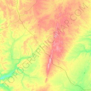
Name: Mugalzhar District topographic map, elevation, terrain.
Location: Mugalzhar District, Aktobe Region, Kazakhstan (47.78804 56.50934 49.87278 59.60018)
Average elevation: 279 m
Minimum elevation: 124 m
Maximum elevation: 646 m
Other topographic maps
Click on a map to view its topography, its elevation and its terrain.
Yrgyz District
Yrgyz District, Aktobe Region, 030400, Kazakhstan
Average elevation: 129 m
Акмола
Акмола, Martuk District, Aktobe Region, Kazakhstan
Average elevation: 212 m