
Musala topographic map
Interactive map
Click on the map to display elevation.
About this map
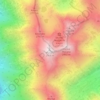
Name: Musala topographic map, elevation, terrain.
Location: Musala, Samokov, Sofia, Bulgaria (42.17914 23.58523 42.17924 23.58533)
Average elevation: 2,520 m
Minimum elevation: 2,017 m
Maximum elevation: 2,921 m
Musala (Bulgarian: Мусала); from Arabic through Ottoman Turkish: from Musalla, "near God" or "place for prayer" is the highest peak in Rila Mountain, also in Bulgaria and the entire Balkan Peninsula, standing at 2,925 metres (9,596 ft). With a topographic prominence of 2,473 metres (8,114 ft), Musala is also the 6th highest peak by topographic prominence in mainland Europe. Musala is also the 3rd most topographically isolated major peak in Continental Europe.
Other topographic maps
Click on a map to view its topography, its elevation and its terrain.