
Hanover topographic map
Interactive map
Click on the map to display elevation.
About this map
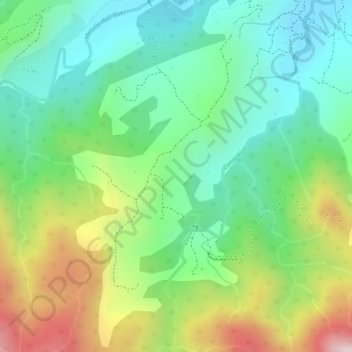
Name: Hanover topographic map, elevation, terrain.
Location: Hanover, Saint Andrew Parish, Dominica (15.51692 -61.32606 15.53692 -61.30606)
Average elevation: 209 m
Minimum elevation: 40 m
Maximum elevation: 494 m
Other topographic maps
Click on a map to view its topography, its elevation and its terrain.
Croix River
Dominica > Saint Andrew Parish > Wesley
Croix River, Wesley, Saint Andrew Parish, Dominica
Average elevation: 112 m
Palmasonian River
Dominica > Saint Andrew Parish > Dos D'Ane
Palmasonian River, Dos D'Ane, Saint Andrew Parish, Dominica
Average elevation: 199 m