
Kangso County topographic map
Interactive map
Click on the map to display elevation.
About this map
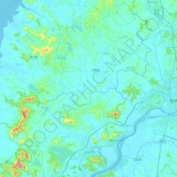
Name: Kangso County topographic map, elevation, terrain.
Location: Kangso County, Pyongannam-do, North Korea (38.86261 125.32323 39.21805 125.67710)
Average elevation: 42 m
Minimum elevation: 0 m
Maximum elevation: 526 m
Other topographic maps
Click on a map to view its topography, its elevation and its terrain.
Pyŏngsŏng
North Korea > Pyongannam-do > Pyŏngsŏng
Pyŏngsŏng, Pyongannam-do, North Korea
Average elevation: 114 m