
Combani topographic map
Interactive map
Click on the map to display elevation.
About this map
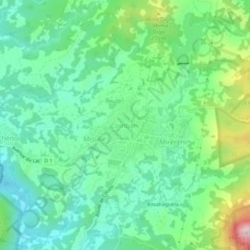
Name: Combani topographic map, elevation, terrain.
Location: Combani, Tsingoni, Mayotte, 97680, France (-12.80717 45.11262 -12.76717 45.15262)
Average elevation: 129 m
Minimum elevation: 2 m
Maximum elevation: 455 m
Other topographic maps
Click on a map to view its topography, its elevation and its terrain.