
Lumberton topographic map
Interactive map
Click on the map to display elevation.
About this map
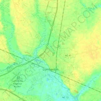
Name: Lumberton topographic map, elevation, terrain.
Location: Lumberton, Robeson County, North Carolina, United States (34.57936 -79.10739 34.70343 -78.96231)
Average elevation: 42 m
Minimum elevation: 32 m
Maximum elevation: 52 m
Other topographic maps
Click on a map to view its topography, its elevation and its terrain.
Maxton
United States > North Carolina > Robeson County
Maxton, Robeson County, North Carolina, United States
Average elevation: 58 m
Rowland
United States > North Carolina > Robeson County > Rowland
Rowland, Robeson County, North Carolina, United States
Average elevation: 45 m