
Mana Island topographic map
Interactive map
Click on the map to display elevation.
About this map
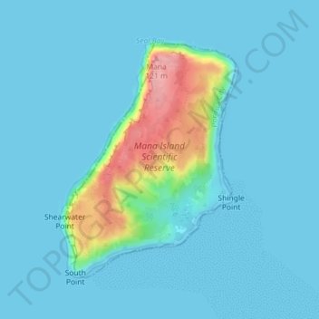
Name: Mana Island topographic map, elevation, terrain.
Location: Mana Island, Porirua, Wellington, New Zealand (-41.09756 174.77026 -41.07760 174.79033)
Average elevation: 16 m
Minimum elevation: 0 m
Maximum elevation: 123 m