
Łambinowice topographic map
Interactive map
Click on the map to display elevation.
About this map
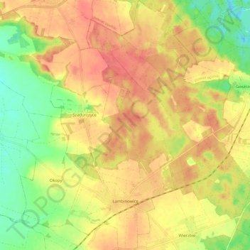
Name: Łambinowice topographic map, elevation, terrain.
Average elevation: 198 m
Minimum elevation: 165 m
Maximum elevation: 221 m
Other topographic maps
Click on a map to view its topography, its elevation and its terrain.
Nysa
Poland > Opole Voivodeship > Nysa County
Nysa, gmina Nysa, Nysa County, Opole Voivodeship, Poland
Average elevation: 202 m
Makowice
Poland > Opole Voivodeship > Nysa County
Makowice, gmina Skoroszyce, Nysa County, Opole Voivodeship, Poland
Average elevation: 192 m