
Greensburg topographic map
Interactive map
Click on the map to display elevation.
About this map
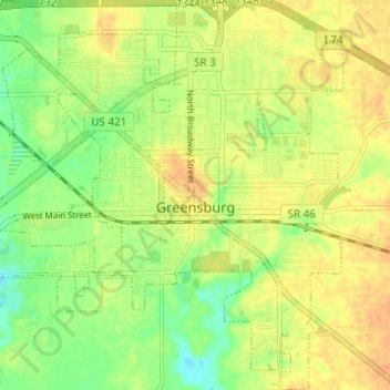
Name: Greensburg topographic map, elevation, terrain.
Location: Greensburg, Decatur County, Indiana, United States (39.31495 -85.51839 39.36250 -85.46018)
Average elevation: 288 m
Minimum elevation: 269 m
Maximum elevation: 301 m
Other topographic maps
Click on a map to view its topography, its elevation and its terrain.
Decatur County
United States > Indiana > Decatur County
Decatur County, Indiana, United States
Average elevation: 275 m