
Bordeaux Mountain topographic map
Interactive map
Click on the map to display elevation.
About this map
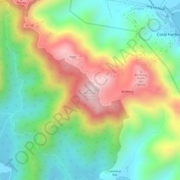
Name: Bordeaux Mountain topographic map, elevation, terrain.
Average elevation: 160 m
Minimum elevation: 0 m
Maximum elevation: 380 m
Other topographic maps
Click on a map to view its topography, its elevation and its terrain.
Fort Christian
USA > United States Virgin Islands > Charlotte Amalie
Fort Christian, Fort Pladsen, Charlotte Amalie, Saint Thomas - Saint John District, United States Virgin Islands, 00804, USA
Average elevation: 73 m