
Fairmount topographic map
Interactive map
Click on the map to display elevation.
About this map
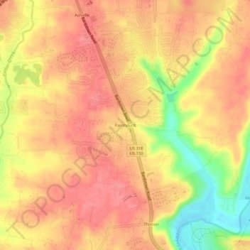
Name: Fairmount topographic map, elevation, terrain.
Location: Fairmount, Jefferson County, Kentucky, 40291, USA (38.09645 -85.59079 38.13645 -85.55079)
Average elevation: 198 m
Minimum elevation: 144 m
Maximum elevation: 222 m