
Port Fairy topographic map
Interactive map
Click on the map to display elevation.
About this map
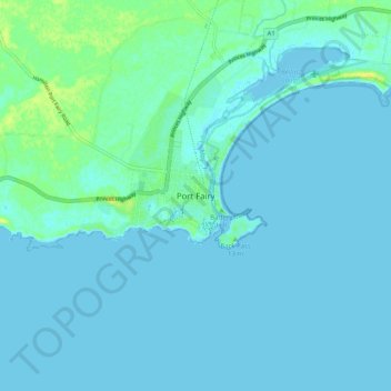
Name: Port Fairy topographic map, elevation, terrain.
Average elevation: 3 m
Minimum elevation: -2 m
Maximum elevation: 20 m
Other topographic maps
Click on a map to view its topography, its elevation and its terrain.
Port Fairy
Australia > Victoria > Port Fairy
Port Fairy, Shire of Moyne, Victoria, 3284, Australia
Average elevation: 22 m