
Malakand topographic map
Interactive map
Click on the map to display elevation.
About this map
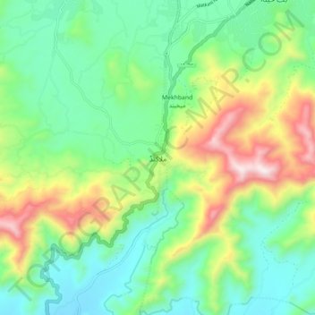
Name: Malakand topographic map, elevation, terrain.
Average elevation: 787 m
Minimum elevation: 495 m
Maximum elevation: 1,409 m
Other topographic maps
Click on a map to view its topography, its elevation and its terrain.
Batkhela
Pakistan > Khyber Pakhtunkhwa > Malakand District
Batkhela, Malakand District, Malakand Division, Khyber Pakhtunkhwa, Pakistan
Average elevation: 834 m
Totakan
Pakistan > Khyber Pakhtunkhwa > Malakand District
Totakan, Swat Ranizai Tehsil, Malakand District, Malakand Division, Khyber Pakhtunkhwa, Pakistan
Average elevation: 657 m