
Bucks Horn Oak topographic map
Interactive map
Click on the map to display elevation.
About this map
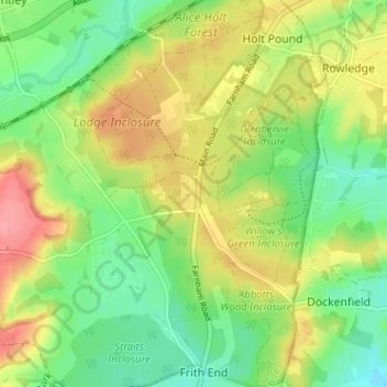
Name: Bucks Horn Oak topographic map, elevation, terrain.
Average elevation: 99 m
Minimum elevation: 60 m
Maximum elevation: 151 m
Other topographic maps
Click on a map to view its topography, its elevation and its terrain.
Blacknest
United Kingdom > England > Hampshire > East Hampshire > Binsted
Blacknest, Binsted, East Hampshire, Hampshire, England, GU34 4QD, United Kingdom
Average elevation: 103 m