
Wych Brook topographic map
Interactive map
Click on the map to display elevation.
About this map
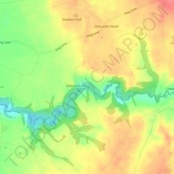
Name: Wych Brook topographic map, elevation, terrain.
Average elevation: 72 m
Minimum elevation: 35 m
Maximum elevation: 101 m
Other topographic maps
Click on a map to view its topography, its elevation and its terrain.
Neston
United Kingdom > England > Chester
Neston, Chester, Cheshire West and Chester, North West England, England, CH64 9UY, United Kingdom
Average elevation: 32 m
City of Chester
United Kingdom > England > Chester
City of Chester, Chester, Cheshire West and Chester, North West England, England, United Kingdom
Average elevation: 21 m
Liverpool Bay
United Kingdom > England > Chester
Liverpool Bay, Chester, Cheshire West and Chester, North West England, England, United Kingdom
Average elevation: 0 m