
Žihle topographic map
Interactive map
Click on the map to display elevation.
About this map
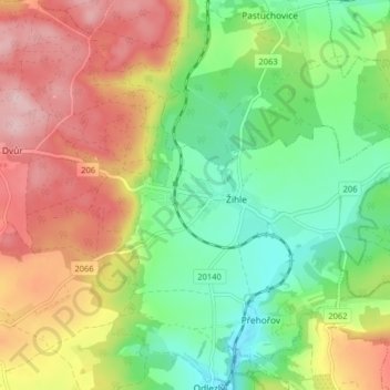
Name: Žihle topographic map, elevation, terrain.
Location: Žihle, okres Plzeň-sever, Plzeňský kraj, Southwest, Czechia (50.03309 13.33200 50.05748 13.41211)
Average elevation: 504 m
Minimum elevation: 420 m
Maximum elevation: 612 m