
Crittenden County topographic map
Interactive map
Click on the map to display elevation.
About this map
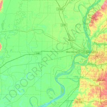
Name: Crittenden County topographic map, elevation, terrain.
Location: Crittenden County, Arkansas, United States (34.83328 -90.50545 35.43988 -90.06461)
Average elevation: 68 m
Minimum elevation: 48 m
Maximum elevation: 134 m
Other topographic maps
Click on a map to view its topography, its elevation and its terrain.
Horseshoe Lake
United States > Arkansas > Crittenden County
Horseshoe Lake, Crittenden County, Arkansas, 72348, United States
Average elevation: 62 m