
Cayo District topographic map
Interactive map
Click on the map to display elevation.
About this map
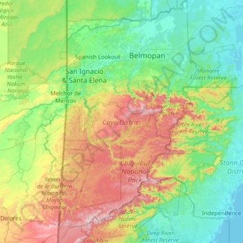
Name: Cayo District topographic map, elevation, terrain.
Location: Cayo District, Belize (16.40050 -89.19301 17.49872 -88.54373)
Average elevation: 274 m
Minimum elevation: -1 m
Maximum elevation: 1,088 m
Other topographic maps
Click on a map to view its topography, its elevation and its terrain.