
Hlotse topographic map
Interactive map
Click on the map to display elevation.
About this map
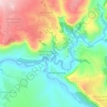
Name: Hlotse topographic map, elevation, terrain.
Location: Hlotse, Leribe District, Lesotho (-28.90051 28.15155 -28.88870 28.19593)
Average elevation: 1,711 m
Minimum elevation: 1,572 m
Maximum elevation: 1,932 m
Other topographic maps
Click on a map to view its topography, its elevation and its terrain.