
Aïr Mountains topographic map
Interactive map
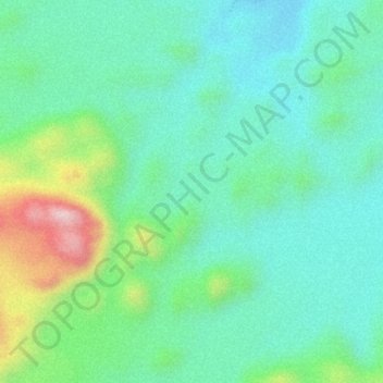
Click on the map to display elevation.
About this map
Name: Aïr Mountains topographic map, elevation, terrain.
Location: Aïr Mountains, Tchirozérine, Agadez Region, Niger (17.84995 8.74995 17.85005 8.75005)
Average elevation: 1,731 m
Minimum elevation: 1,645 m
Maximum elevation: 1,942 m
The Aïr Mountains or Aïr Massif (Tamashek: Ayăr; Hausa: Eastern Azbin, Western Abzin) is a triangular massif, located in northern Niger, within the Sahara. Part of the West Saharan montane xeric woodlands ecoregion, they rise to more than 1,800 m (5,900 ft) and extend over 84,000 km2 (32,000 sq mi). Lying in the midst of desert north of the 17th parallel, the Aïr plateau, with an average altitude between 500 and 900 m (1,600 and 3,000 ft), forms an island of Sahel climate which supports a wide variety of life, many pastoral and farming communities, and dramatic geological and archaeological sites. There are notable archaeological excavations in the region that illustrate the prehistoric past of this region. The endangered African wild dog (Lycaon pictus) once existed in this region, but may now be extirpated due to human population pressures in this region.
Other topographic maps
Click on a map to view its topography, its elevation and its terrain.