
Adak Island topographic map
Interactive map
Click on the map to display elevation.
About this map
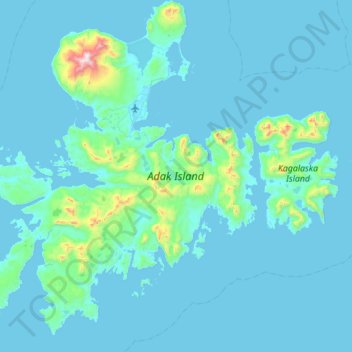
Name: Adak Island topographic map, elevation, terrain.
Location: Adak Island, Unorganized Borough, Alaska, 99546, USA (51.59059 -176.99232 52.00178 -176.41895)
Average elevation: 68 m
Minimum elevation: -3 m
Maximum elevation: 1,144 m
Other topographic maps
Click on a map to view its topography, its elevation and its terrain.