
High Halden topographic map
Interactive map
Click on the map to display elevation.
About this map
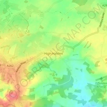
Name: High Halden topographic map, elevation, terrain.
Location: High Halden, Kent, South East, England, TN26 3LR, United Kingdom (51.08355 0.69123 51.12355 0.73123)
Average elevation: 38 m
Minimum elevation: 8 m
Maximum elevation: 76 m