
Checkley topographic map
Interactive map
Click on the map to display elevation.
About this map
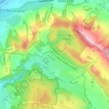
Name: Checkley topographic map, elevation, terrain.
Average elevation: 134 m
Minimum elevation: 47 m
Maximum elevation: 271 m
Other topographic maps
Click on a map to view its topography, its elevation and its terrain.
Blakenhall
United Kingdom > England > Checkley
Blakenhall, Checkley, Cheshire East, North West England, England, United Kingdom
Average elevation: 75 m