
Moreton Say topographic map
Interactive map
Click on the map to display elevation.
About this map
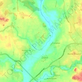
Name: Moreton Say topographic map, elevation, terrain.
Average elevation: 85 m
Minimum elevation: 59 m
Maximum elevation: 121 m
Other topographic maps
Click on a map to view its topography, its elevation and its terrain.
Longford
United Kingdom > England > Longford
Longford, Gloucestershire, South West England, England, GL2 9BT, United Kingdom
Average elevation: 14 m
Longford
United Kingdom > England > Longford
Longford, Derbyshire, East Midlands, England, DE6 3DR, United Kingdom
Average elevation: 96 m