
Monti Lattari topographic map
Interactive map
Click on the map to display elevation.
About this map
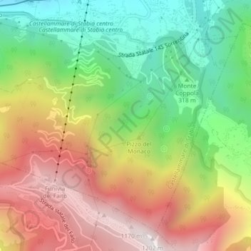
Name: Monti Lattari topographic map, elevation, terrain.
Location: Monti Lattari, Castellammare di Stabia, NA, CAM, 80053, Italia (40.67679 14.48660 40.67689 14.48670)
Average elevation: 552 m
Minimum elevation: 8 m
Maximum elevation: 1,179 m