
Gary topographic map
Interactive map
Click on the map to display elevation.
About this map
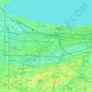
Name: Gary topographic map, elevation, terrain.
Location: Gary, Lake County, Indiana, United States (41.52197 -87.43311 41.65006 -87.22205)
Average elevation: 185 m
Minimum elevation: 173 m
Maximum elevation: 224 m
Other topographic maps
Click on a map to view its topography, its elevation and its terrain.
Glen Park
United States > Indiana > Lake County > Gary
Glen Park, Gary, Lake County, Indiana, 46409, United States
Average elevation: 193 m
Miller
United States > Indiana > Lake County > Gary > Miller
Miller, Gary, Lake County, Indiana, 46403, United States
Average elevation: 186 m