
El Mosquitero topographic map
Interactive map
Click on the map to display elevation.
About this map
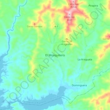
Name: El Mosquitero topographic map, elevation, terrain.
Location: El Mosquitero, Distrito Carlos Arvelo, Carabobo, Venezuela (9.88398 -68.13253 9.96398 -68.05253)
Average elevation: 443 m
Minimum elevation: 353 m
Maximum elevation: 704 m