
Red Brook topographic map
Interactive map
Click on the map to display elevation.
About this map
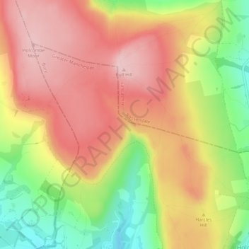
Name: Red Brook topographic map, elevation, terrain.
Average elevation: 334 m
Minimum elevation: 220 m
Maximum elevation: 416 m
Other topographic maps
Click on a map to view its topography, its elevation and its terrain.
Lumb
United Kingdom > England > Rossendale > Lumb
Lumb, Rossendale, Lancashire, North West England, England, BL0 0QJ, United Kingdom
Average elevation: 230 m