
Gulf of Papua topographic map
Interactive map
Click on the map to display elevation.
About this map
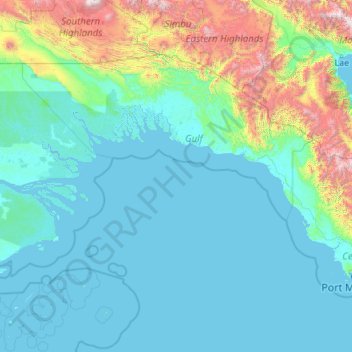
Name: Gulf of Papua topographic map, elevation, terrain.
Average elevation: 394 m
Minimum elevation: -2 m
Maximum elevation: 4,036 m
Other topographic maps
Click on a map to view its topography, its elevation and its terrain.
Kerema District
Papua New Guinea > Gulf > Kerema District
Kerema District, Gulf, Southern Region, Papua New Guinea
Average elevation: 488 m