
Palais Rihour topographic map
Interactive map
Click on the map to display elevation.
About this map
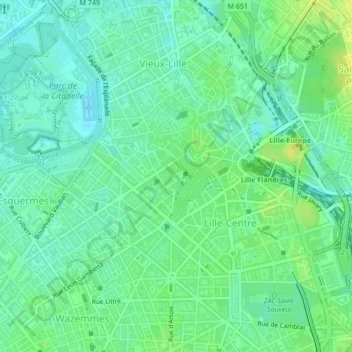
Name: Palais Rihour topographic map, elevation, terrain.
Average elevation: 28 m
Minimum elevation: 18 m
Maximum elevation: 45 m
Other topographic maps
Click on a map to view its topography, its elevation and its terrain.
Vauban Esquermes
France > Hauts-de-France > Lille
Vauban Esquermes, Lille, Nord, Hauts-de-France, France métropolitaine, France
Average elevation: 26 m
Parc Naturel Urbain de Lomme
France > Hauts-de-France > Lille
Parc Naturel Urbain de Lomme, Lomme, Lille, Nord, Hauts-de-France, France métropolitaine, 59160, France
Average elevation: 36 m
Lille-Moulins
France > Hauts-de-France > Lille
Lille-Moulins, Lille, Nord, Hauts-de-France, France métropolitaine, 59034, France
Average elevation: 33 m