
Kielder Water topographic map
Interactive map
Click on the map to display elevation.
About this map
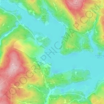
Name: Kielder Water topographic map, elevation, terrain.
Average elevation: 239 m
Minimum elevation: 176 m
Maximum elevation: 368 m
Other topographic maps
Click on a map to view its topography, its elevation and its terrain.
Robin's Knowe
United Kingdom > England > Northumberland > Falstone
Robin's Knowe, Falstone, Northumberland, North of Tyne, England, NE48 1BX, United Kingdom
Average elevation: 352 m