
Whernside topographic map
Interactive map
Click on the map to display elevation.
About this map
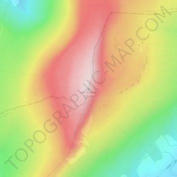
Name: Whernside topographic map, elevation, terrain.
Average elevation: 533 m
Minimum elevation: 303 m
Maximum elevation: 733 m
Other topographic maps
Click on a map to view its topography, its elevation and its terrain.
Ingleborough
United Kingdom > England > North Yorkshire > Ingleton
Ingleborough, Ingleton, North Yorkshire, England, LA6 3JG, United Kingdom
Average elevation: 499 m