
Tapa topographic map
Interactive map
Click on the map to display elevation.
About this map
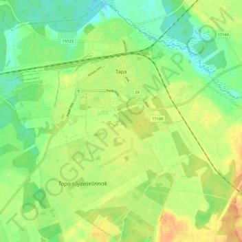
Name: Tapa topographic map, elevation, terrain.
Location: Tapa, Tapa vald, Lääne-Viru maakond, Estonia (59.22275 25.90255 59.27824 25.99135)
Average elevation: 99 m
Minimum elevation: 82 m
Maximum elevation: 116 m