
Lomé topographic map
Interactive map
Click on the map to display elevation.
About this map
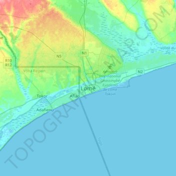
Name: Lomé topographic map, elevation, terrain.
Location: Lomé, 4th District, 01 BP 3679, Togo (5.97042 1.05583 6.29042 1.37583)
Average elevation: 12 m
Minimum elevation: -5 m
Maximum elevation: 76 m
Other topographic maps
Click on a map to view its topography, its elevation and its terrain.