
Barra topographic map
Interactive map
Click on the map to display elevation.
About this map
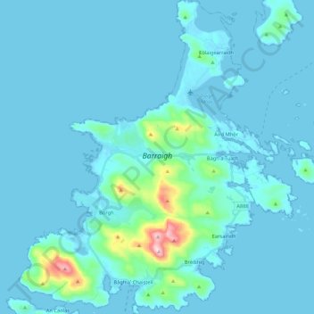
Name: Barra topographic map, elevation, terrain.
Location: Barra, Northbay, Western Isles, Scotland, United Kingdom (56.94325 -7.56278 57.05895 -7.36846)
Average elevation: 27 m
Minimum elevation: -1 m
Maximum elevation: 373 m
Other topographic maps
Click on a map to view its topography, its elevation and its terrain.
Bogach
United Kingdom > Scotland > Western Isles > Northbay > Bogach
Bogach, Northbay, Western Isles, Scotland, HS9 5UX, United Kingdom
Average elevation: 32 m