
Caloosahatchee River topographic map
Interactive map
Click on the map to display elevation.
About this map
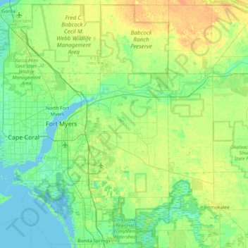
Name: Caloosahatchee River topographic map, elevation, terrain.
Location: Caloosahatchee River, Lee County, Florida, 33920, USA (26.45469 -82.01771 26.79808 -81.30518)
Average elevation: 8 m
Minimum elevation: -1 m
Maximum elevation: 24 m
Other topographic maps
Click on a map to view its topography, its elevation and its terrain.