
Wollaston Lake topographic map
Interactive map
Click on the map to display elevation.
About this map
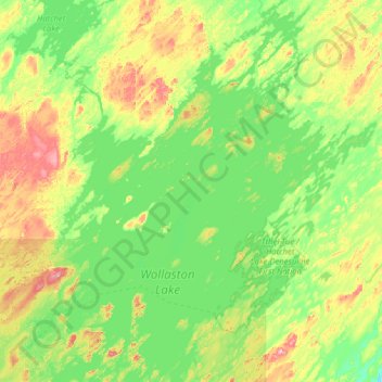
Name: Wollaston Lake topographic map, elevation, terrain.
Average elevation: 413 m
Minimum elevation: 376 m
Maximum elevation: 531 m
Other topographic maps
Click on a map to view its topography, its elevation and its terrain.
Black Lake
Canada > Saskatchewan > Northern Saskatchewan Administration District > Black Lake
Black Lake, Northern Saskatchewan Administration District, Saskatchewan, Canada
Average elevation: 293 m
Pelican Narrows
Canada > Saskatchewan > Northern Saskatchewan Administration District > Pelican Narrows
Pelican Narrows, Northern Saskatchewan Administration District, Saskatchewan, Canada
Average elevation: 321 m
Denare Beach
Canada > Saskatchewan > Northern Saskatchewan Administration District > Denare Beach
Denare Beach, Northern Saskatchewan Administration District, Saskatchewan, Canada
Average elevation: 308 m