
Etosha Pan topographic map
Interactive map
Click on the map to display elevation.
About this map
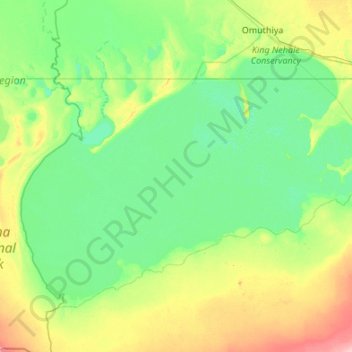
Name: Etosha Pan topographic map, elevation, terrain.
Location: Etosha Pan, Oshikoto, Namibia (-19.14227 15.84045 -18.42147 16.91843)
Average elevation: 1,097 m
Minimum elevation: 1,074 m
Maximum elevation: 1,188 m
Other topographic maps
Click on a map to view its topography, its elevation and its terrain.