
Aishalton topographic map
Interactive map
Click on the map to display elevation.
About this map
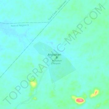
Name: Aishalton topographic map, elevation, terrain.
Average elevation: 168 m
Minimum elevation: 149 m
Maximum elevation: 287 m
Aishalton village is located in the Rupununi savannah lands in the South of Guyana, at an altitude of 187 metres. Neighbouring villages are Karaudarnau to the west and Awarewaunau to the east. Lethem, the regional capital of the Upper Takutu-Upper Essequibo region, is situated 180 km north west of Aishalton; and Dadanawa Ranch is located approximately halfway between these two centres.