
Emberton Country Park topographic map
Interactive map
Click on the map to display elevation.
About this map
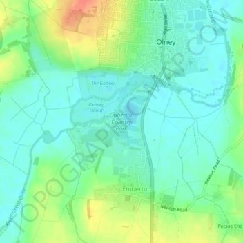
Name: Emberton Country Park topographic map, elevation, terrain.
Average elevation: 59 m
Minimum elevation: 44 m
Maximum elevation: 90 m
Other topographic maps
Click on a map to view its topography, its elevation and its terrain.
Emberton
United Kingdom > England > Emberton
Emberton, South East, England, MK46 5BX, United Kingdom
Average elevation: 69 m