
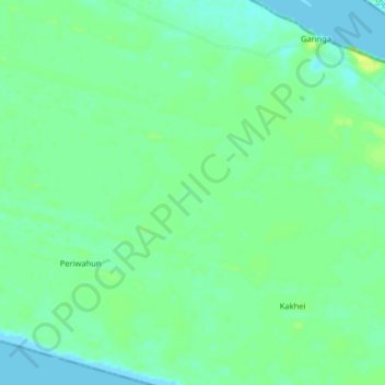
Turners Peninsula topographic map
Interactive map
Click on the map to display elevation.
About this map
Name: Turners Peninsula topographic map, elevation, terrain.
Average elevation: 8 m
Minimum elevation: -1 m
Maximum elevation: 16 m
Other topographic maps
Click on a map to view its topography, its elevation and its terrain.
Sherbro
Sierra Leone > Southern Province
Sherbro, Bonthe District, Southern Province, Sierra Leone
Average elevation: 2 m
Kabati
Sierra Leone > Southern Province > Kabati
Kabati, Bonthe District, Southern Province, Sierra Leone
Average elevation: 41 m
Koribondo
Sierra Leone > Southern Province > Koribondo
Koribondo, Bo District, Southern Province, Sierra Leone
Average elevation: 74 m
Fabu
Sierra Leone > Southern Province > Fabu
Fabu, Bo District, Southern Province, Sierra Leone
Average elevation: 101 m
Fengehun
Sierra Leone > Southern Province > Fengehun
Fengehun, Bo District, Southern Province, Sierra Leone
Average elevation: 109 m
Vaama
Sierra Leone > Southern Province > Vaama
Vaama, Pujehun District, Southern Province, Sierra Leone
Average elevation: 9 m
Lake Mape
Sierra Leone > Southern Province > Petema
Lake Mape, Gandorhun, Petema, Pujehun District, Southern Province, Sierra Leone
Average elevation: 5 m