
Strathyre topographic map
Interactive map
Click on the map to display elevation.
About this map
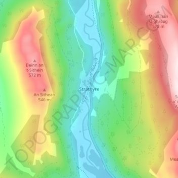
Name: Strathyre topographic map, elevation, terrain.
Location: Strathyre, Stirling, Scotland, FK18, United Kingdom (56.30450 -4.34930 56.34450 -4.30930)
Average elevation: 326 m
Minimum elevation: 119 m
Maximum elevation: 638 m